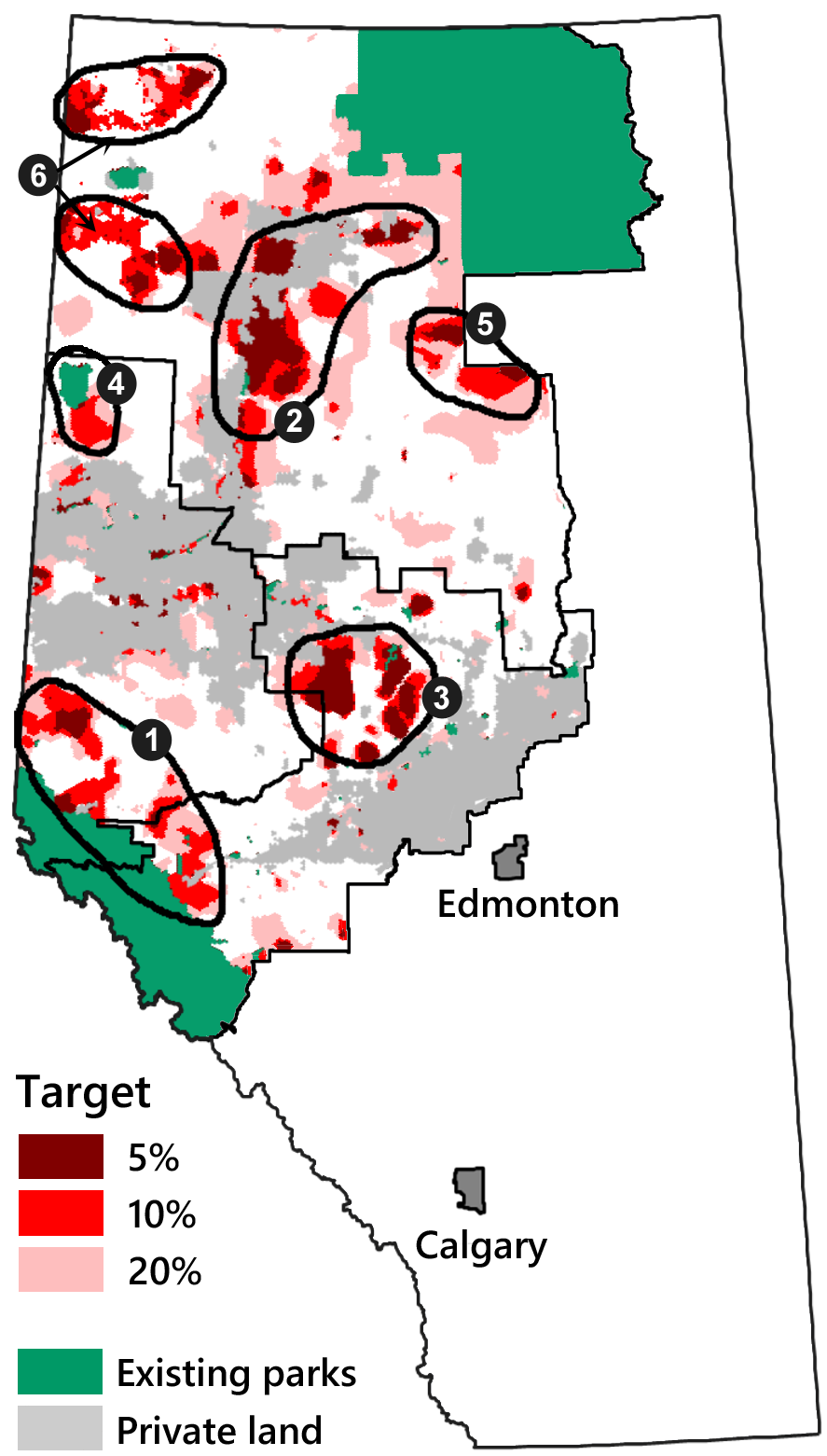
Fig. 11.29. A map of the planning units consistently selected in the base scenario with fine-filter elements added, at three levels of representation (see text for how the targets were applied). The six numbered areas outlined in black were identified by the working group as priority areas for establishing large, contiguous reserves (in rough order of priority). The two areas labelled 6 contain similar features and are interchangeable.
