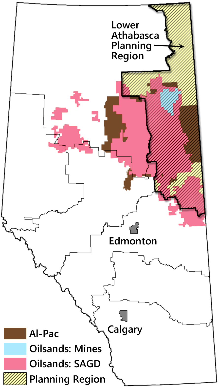
Fig. 11.6. The Land-Use Framework defined seven regional planning areas (outlined in thin black lines). The 93,000 km2 Lower Athabasca Regional Plan area is highlighted in hatched yellow. The location of the Al-Pac FMA and the oilsands deposits are also shown (SAGD = recovery via steam-assisted gravity drainage).