Fig. 2.6. The total area of farms in the Prairie provinces (blue) and the rest of Canada (red), 1901–2001. Source: Statistics Canada.
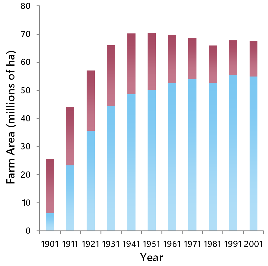
Fig. 2.6. The total area of farms in the Prairie provinces (blue) and the rest of Canada (red), 1901–2001. Source: Statistics Canada.
Canadian Centre for Translational Ecology. 2019 © Creative Commons Attribution ShareAlike License 4.0